| Title: | Burnt Lake |
| Area: | Mt Hood Wilderness |
| Size: | 6 Acres |
| Depth: | 25 Feet |
| Elevation: | 4100 Feet |
| Elevation_Gain: | 1420 |
| Snow_Free: | May 23 |
| Camp_Sites: | 8 |
| Trail: | Burnt Lake Trail |
| Misc: | The lake has a good population of crayfish. |
| Notes: | This is a very popular lake for swimming and camping, with great short hikes available to scenic spots. The trail is very steep with horses not allowed. A Northwest Forest Pass is needed to park at the trailhead. Check the link for the Trail Report below for current trail conditions. |
| Trail_Number: | 772 |
| Route: | from Zigzag take #18 to #1825 to #109 to trailhead |
| TH_Access: | Apr 05 |
| TH_elevation: | 2680 |
| Alt_trail: | #772 Burnt Lk Tr (Devil Canyon route) 4.5 mi/ 700' gain |
| Distance: | 3 |
| Features: | swimming/scenic |
| USGS_15: | Government Camp |
| USGS_75: | Government Camp |
| Reference: | Lakes of Oregon #4/ Fishing in Oregon by Sheehan / 62 Hiking Trails - North Oregon Cascades by Lowe / Exploring Oregon's Wild Areas by Sullivan |
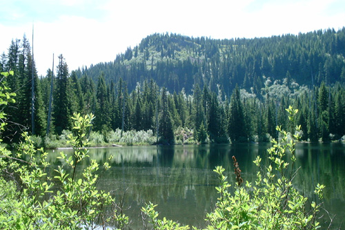
photo by Omar Bose - - - July 11, 2002 |
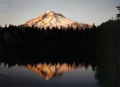
Sunset on Mt Hood from Burnt Lake - photo by Teri Page June 28, 2003 |
| Type: | Lake |
| Scenic: | yes |
| Swimming: | yes |