| Title: | Averill Lake |
| Area: | Olallie Scenic Area |
| Size: | 12 Acres |
| Depth: | 11 Feet |
| Elevation: | 4650 Feet |
| Elevation_Gain: | 1050 |
| Snow_Free: | Jun 11 |
| Camp_Sites: | 4 |
| Trail: | Red Lake Trail |
| Misc: | Last stocked in 2001 with brook trout |
| Difficulty: | backpack |
| Notes: | Averill Lake is named for Ed Averill, State Fish Protector for many years in the 1920s. Of the lakes along the Red Lake Trail, this one, due to a lot of flat area, as the largest amount of campsite space. |
| Synopsis: | just wondering where this would show up |
| Trail_Number: | 719 |
| Route: | from Detroit take Breitenbush Rd #46 to rd #380 |
| TH_Access: | May 07 |
| TH_elevation: | 3600 |
| Alt_trail: | Fish Lk Tr#717 from Lower Lake Camp Ground 3.0 mi -110 ft |
| Distance: | 2 |
| Features: | solitude |
| USGS_15: | Breitenbush |
| USGS_75: | Olallie Butte |
| Reference: | Fishing in Oregon/ Lakes of Oregon #5/ Olallie Scenic Area Guidebook/ 62 Hiking Trails-North Oregon Cascades/ 100 Hikes Northwest Oregon/ Oregon Geographic Names |
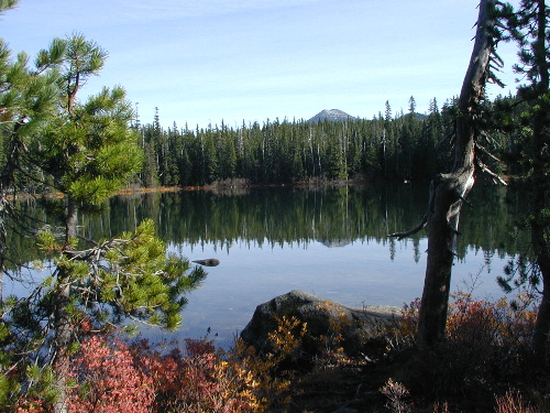
Averil Lake in it's fall colors with Olallie Butte in the distance |
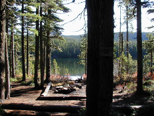
A campsite at Averil Lake |
| Type: | Lake |
| Backpack: | yes |
| Fishing: | yes |
| Solitude: | yes |