| Title: | Carl Lake |
| Area: | Mt Jefferson Wilderness |
| Size: | 20 Acres |
| Depth: | 51 Feet |
| Elevation: | 5490 Feet |
| Elevation_Gain: | 920 |
| Snow_Free: | Jul 09 |
| Camp_Sites: | 11 |
| Trail: | Cabot Lake Trail (old #68) |
| Misc: | The connecting trail between Carl Lake and the Pacific Crest Trail, although not shown on most recreational maps, is shown on the USGS quad map. |
| Difficulty: | backpack |
| Trail_Number: | 4003 |
| Route: | beyond Suttle Lake take #12 north to #1230 to Cabot Lake Trail Head |
| TH_Access: | Jun 09 |
| TH_elevation: | 4570 |
| Alt_trail: | #4002 Sugar Pine Ridge Trail 9.8 miles (old #65) |
| Distance: | 5 |
| Features: | fishing, scenic, camping |
| USGS_15: | Mt Jefferson |
| USGS_75: | Marion Lake |
| Reference: | Mt Jefferson Wilderness Guidebook by George / Fishing in Oregon by Sheehan / 100 Hikes Central Oregon Cascades by Sullivan |
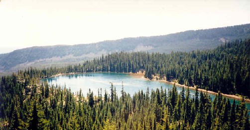
Carl Lake - - - - - August 20, 1988 |
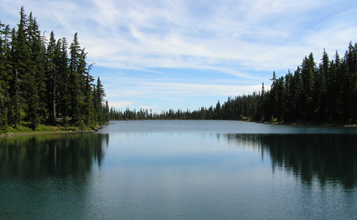
Carl Lake - - - - August 18, 2004 |
| Type: | Lake |
| Backpack: | yes |
| Fishing: | yes |
| Scenic: | yes |