| Title: | Olallie Butte |
| Area: | Warm Springs Indian Reservation |
| Elevation: | 7215 Feet |
| Elevation_Gain: | 2570 |
| Trail: | Olallie Butte |
| Links: | Olallie Butte Lookout |
| Notes: | The trail to the summit of Olallie Butte provides one of the better scenic hikes in the Cascades, however trail signage and maintenance are non-existent. The trailhead is in the Mt Hood National Forest, but the bulk of the butte belongs to the Confederated Tribes of Warm Springs. At the top you will find the crumbling remains of the fire lookout that was abandoned in 1967. Take along a map to be able to identify the many lakes in the Olallie Scenic Area as well as lakes on the Warm Springs Reservation. |
| Trail_Number: | 720 |
| Route: | from Detroit take Breitenbush Rd #46 for 25 miles turning right on Rd 4690, and right on Rd 4220. At the power line, park on the right side. The trail takes off on the left side. |
| TH_elevation: | 4645 |
| Distance: | 4.0 |
| USGS_15: | Breitenbush Hot Springs |
| USGS_75: | Olallie Butte |
| Reference: | 62 Hiking Trails Northern Oregon Cascades by Lowe / Fire Lookouts of Oregon & Washington by Kresek |
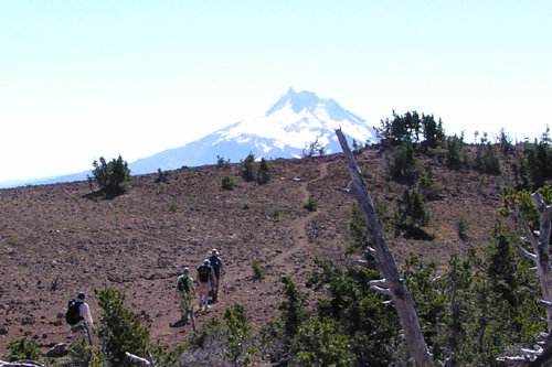
Mt Jefferson in the background from Olallie Butte - - October 3, 2004 |
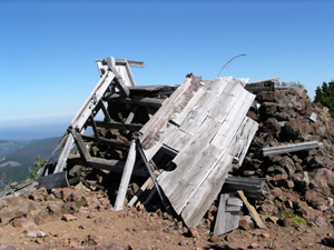
abandoned lookout - - - October 3, 2004 |
| Type: | Peak |
| Day_Hike: | yes |
| Scenic: | yes |